Barrobo District (Barobo)
Barrobo District is a district of Liberia, one of the three located in Maryland County.
Barrobo is the largest of the various Grebo sub-tribes in Maryland County, Republic of Liberia. In the days of tribal wars they fought surrounding tribes to secure a large portion of land. Their military strength in those days enabled them to wipe out the entire tribe of Gbaylo. The land previously occupied by the Gbaylo tribe is currently a property of the Barrobo people. To control their warlike nature, President Edwin Barclay of Liberia built a military barak among them. The soldiers of Camp King used suppression, hard labor and intimidation to keep them in check. Besides, they were subjected to smaller tribes in the administrative arrangement of the Liberian central government. First, they were part of the Webbo district. When Grand Gedeh county was established and Webbo became part of Grand Gedeh, the Barrobo tribe was subjected to the smaller tribe of Boah. The most prominent paramount chiefs during the chieftaincy period were Peter Brooks of Feloken and Sunday Karmanue of Rock Town. On September 18, 1980, the Liberian legislature passed an act creating Barrobo as a statutory district, with Paramount Chief John Togba becoming the first district superintendent. Since then, September 18 has been celebrated annually by the citizens of the district. , the superintendents of Barrobo since it became a district have been:
* John Togba – 1980–1981
* Ralph Clark – 1981–1986
* Fred D. Goe, Sr – 1986–1990
* None (a period of civil war and anarchy) – 1990–1997
* Joseph Weah – January – April 1997
* Victor Carngbe – 1997–2005
* William B. Nagbe – 2005–2010
* Samuel Sorwleh – 2010–2012
Map - Barrobo District (Barobo)
Map
Country - Liberia
 |
 |
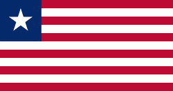
| Flag of Liberia | |
Liberia began in the early 19th century as a project of the American Colonization Society (ACS), which believed black people would face better chances for freedom and prosperity in Africa than in the United States. Between 1822 and the outbreak of the American Civil War in 1861, more than 15,000 freed and free-born African Americans, along with 3,198 Afro-Caribbeans, relocated to Liberia. Gradually developing an Americo-Liberian identity, the settlers carried their culture and tradition with them. Liberia declared independence on July 26, 1847, which the U.S. did not recognize until February 5, 1862.
Currency / Language
| ISO | Currency | Symbol | Significant figures |
|---|---|---|---|
| LRD | Liberian dollar | $ | 2 |
| ISO | Language |
|---|---|
| EN | English language |


